

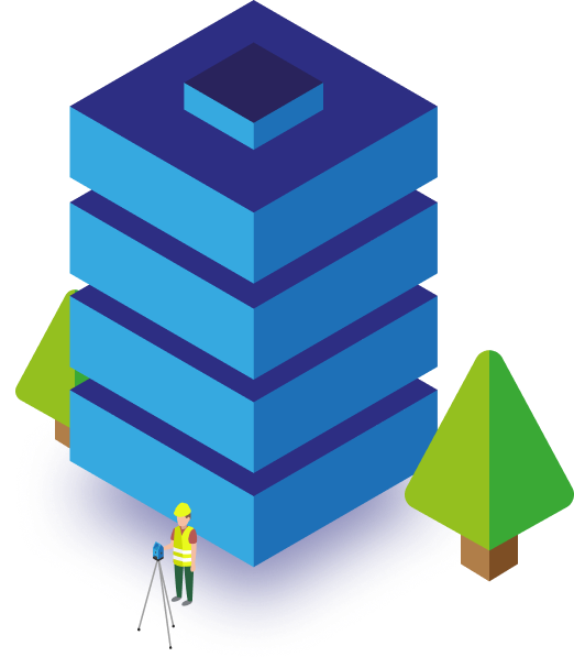
Chartered Surveyors
Measured Building Surveyors | Regulated by RICS
You’re in good company:


MeasuredBuildings.co.uk make surveys easy
How much does a measured building survey cost?

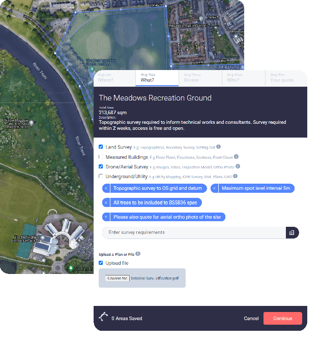
Map your site with our survey mapping tool
Click around the building(s) to be surveyed and select from Measured Building Survey and associated services.

Get your Measured Building Survey quote
We’ll contact you to discuss any details and we provide quotes as a fixed price.

Happy? Arrange access & wait for your drawings
We’ll take it from here and provide clear and accurate drawings to a pre-agreed timescale.
Chartered, regulated & insured
Why use MeasuredBuildings.co.uk?
Technical Expertise
We have measured all manner of buildings using techniques ranging from traditional hand measurements to the latest in 3d laser scanning, drones and point clouds.
Accurate and Precise
We use high-end total stations, 3D laser scanners, drones and GPS units in experienced hands.
Modern service
We harness technology to bring you service designed for the modern working professional.
Combine surveys
Manage costs by combining your measured building survey with other surveys often required in unison, such as topographic surveys.
Discrete & Confidential
Our surveyors on site respect our clients confidential information and this culture runs throughout the project lifecycle.
Regulated by RICS
We practice to globally recognised ethical and professional standards. RICS best practice is at the heart of our workflows.
Chartered Land Surveyors offering
Measured Surveys of Buildings & Land
We provide a wide range of survey solutions including measured building surveys, topographic surveys, Land Registry plan surveys, laser scanning, drone surveys and utility mapping GPR Surveys.

MeasuredBuildings.co.uk - Quality Measured Surveys
A comprehensive range of measured surveys
Browse our services and view sample surveys and examples. Contact us to discuss your project or invite us to quote online.
Measured Buildings
Floorplan Surveys - Outline Elevations - Detailed Elevations - Cross Sections - 3D Laser Scanning - Point Cloud Surveys - Roof Plans - Reflective Ceiling Plans - Street Scene Drawings - Internal Elevations
Engineering Surveys
Setting Out Surveyors - Control Networks - Volume Analysis - Monitoring Surveys - 3D Scanning - Levelling Surveys
Land Surveys
Topographic Surveys - As Built Surveys - Watercourse Surveys - GPS Surveys - Digital Terrain Models - Green & Brownfield Development Sites - 2D & 3D Formats
Drone Surveys
100% Safety Record - High Res Images & Video - Point Clouds - Surface Models - Orthorectified Images - Roof Surveys - Stockpile Surveys - Inspection Models - CAA & RICS
Boundary/Land Registry Surveys
Boundary Measurement - Land Transfer Plans - Agreement/Determined Boundary Plans - Easement Plans - Land Registry Compliant - Expert Witness CPR 35 (commercial only)
Underground Surveys
Site Markup - GPR Surveys - Utility Mapping - Buried Service Location - CCTV Surveys - UXO Surveys - Statutory Record Search - PAS 128 Surveys - Drainage Surveys - Magnetometry - Archaeological

MeasuredBuildings.co.uk
Helping you understand your buildings
Digitising the natural and built environment is what we do. Delivered in your choice of electronic format to support a wide range of architectural, planning and engineering disciplines and skill sets.