
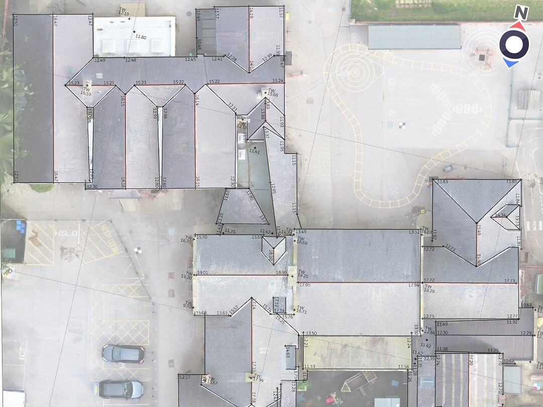
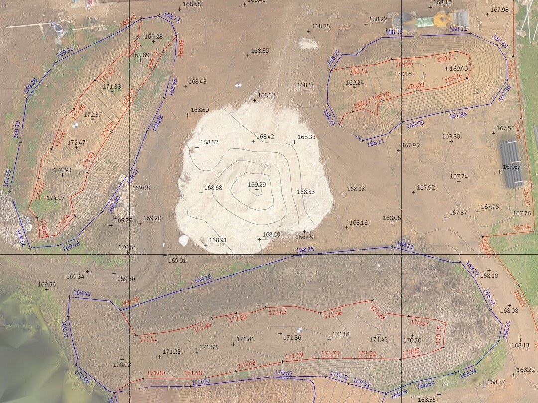
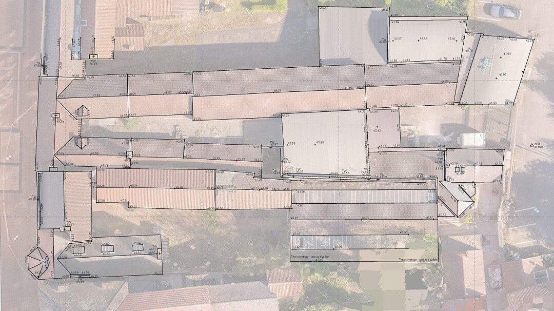
An orthophoto can be used to measure the true distances between the features shown in the photo. Using a carefully planned flight plan and survey methodology, we can provide scaled, orthorectified imagery, with or without survey data overlaid.
A scaled orthophoto can provide a survey grade, cost effective and up to date background image for topographical surveys and roof layout surveys. The images can also be used independently for mapping tasks where level is not necessary.
Using fully qualified pilots and surveyors with comprehensive permissions and insurances, we have a 100% safety record.
Incorporating aerial survey & inspection data can reduce project timescales, allow access to dangerous or hard to reach areas and provide enhanced drawings to work with.
Back to Services including, Drone Images & Video, 3D Inspection Models, Measured Building Surveys & Underground Surveys